Transcribed
Approximate Drive Times To and From Michigan State University
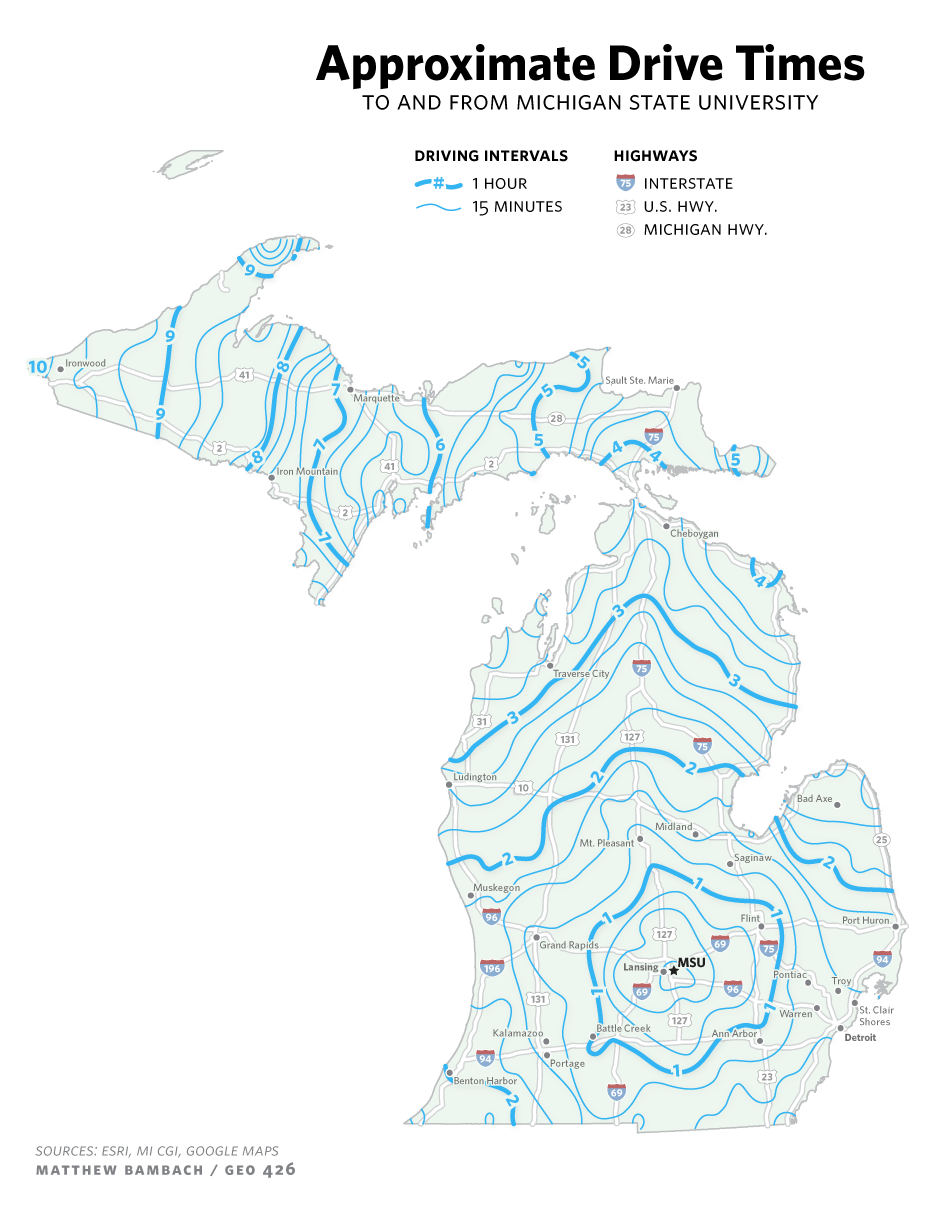
Approximate Drive Times TO AND FROM MICHIGAN STATE UNIVERSITY DRIVING INTERVALS HIGHWAYS #- 1 HOUR 75 INTERSTATE 15 MINUTES 23 U.S. HWY. 28 MICHIGAN HWY. 10/. Ironwood Sault Ste. Marie Marquette 28 5. Iron Mountain Cheboygan Traverse City 31 131 127 75 Ludington 10 Bad Axe. Midland Mt. Pléasant (25 Saginaw. Muskegon 96 Flint Port Huron 127 Grand Rapids 69 94 196 LansingMSU Pontiac Troy 69 96 131 St. Clair Shores Warren 127 ILAnn Arbor Battle Creek Kalamazoo Detroit 94 Portage Benton Harbor 23 SOURCES: ESRI, MI CGI, GOOGLE MAPS MATTHEW BAMBACH / GEO 426
Approximate Drive Times To and From Michigan State University
shared by mbambach on Apr 03
1,305
views
1
fave
1
comment
To create this map, tons of driving distance data points were collected via inputting latitude + longitude coordinates in google maps. These values were then plotted, interpolated, and then cropped in...
ArcMap. Finishing touches were applied in Illustrator.
Source
http://www.f...7389152563Category
TransportationGet a Quote
You may also like...