Transcribed
A Time Table
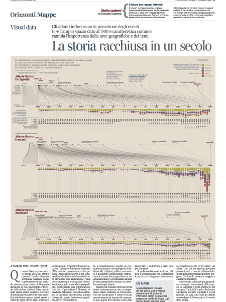
ATIME TABLE WASHINGTON D.C. yane AND ALSO SHOWING THE IR AIR-LINE DISTANCE FROM WASHINGTON. DISTRIBUTION OF COLORS. NA AMNNC INDICATING THE DIFFERENCE IN TIME BETWEEN THE PRINCIPAL CITIES OF THE WORLD,
A Time Table
shared by judithgold on Dec 15
1,689
views
0
faves
1
comment
This infographic from the victorian age provides information about the difference of time among the principal cities around the world and their airline distance from Washington.
Source
Unknown. Add a sourceCategory
TransportationGet a Quote