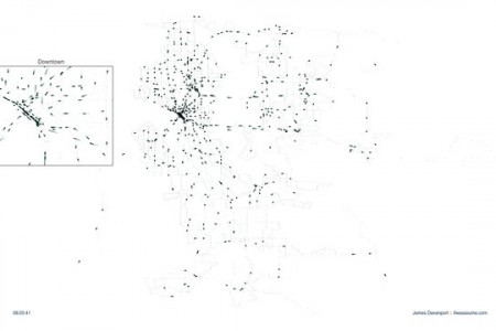
Seattle Map: How Far Can You Get in 45 Minutes?
Transit Time Map: Seattle, 9:00am Technology Preview - Runs Slowly! Seattle, WA UE Click the map to see how far you can travel in 45 minutes on public transit. Bear Sand Point 00 Ballard South Redmond Windermere Rose Hill INDELJL bay Juanita Southe Redm Lawton Perk Lake Washington Hunts Point суде Hаl 405 Bar dge 520 Adelai Briarclit Inter pay 520 Yarrow Point Overlake S: Вгoadmoor Kenilwo Bainbridge Island Medina Highlands Bellevue Lake Hills Seattle Moorland West Lake Hills Sammami Lake Port Blakely Leschi McGilvara Beaux Arts Village West Lake Sammami: 90 Wauta a Bes Harbor sland Fort Ward Factoria W Seattle Fwy Eastgate Sure Mercer Island Hazelwood Newport 405 Seward Park Mallester Hilltop Seaview Hills 509 Holly Park POWERED BY Newcastle Coal Cree Gevgle Boeing Field-King County Map data ©2010 Google Terms ofCtsa Travel time: 15 minutes 30 minutes 45 minutes 9:00am Departure time: Weekday S Express Blakely A
Seattle Map: How Far Can You Get in 45 Minutes?
Publisher
Walk ScoreSource
Unknown. Add a sourceCategory
TravelGet a Quote


