
Transcribed
Mapping Three Decades of Japanese Earthquakes
HOKkaldo Magnitude : North Korea Depth (km) yongyang O 0- 35 • 35 - 70 O 70 - 150 150 - 300 East Sea O 300 - 500 Seoul 500 - 800 Sea of Japan t Sea South Korea Honshu Japań Tokyo Cheju do Seto Naikai LAwaji-shima Hirado-shima Fukue-jima Shikoku kyushu Tanega-shima
Mapping Three Decades of Japanese Earthquakes
shared by IGEmp on Mar 22
478
views
0
faves
0
comments
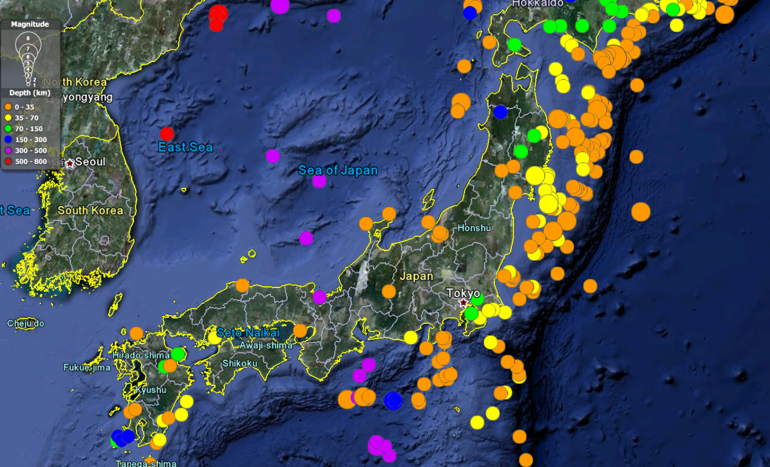
Using data collected by the U.S. Geological Survey, anyone can download historical data on earthquakes across the globe in various formats. Here’s a screenshot in Google Earth from a KML file downlo...
aded today. It shows 30 years of earthquakes — in this extent focused on Japan — with colors representing depth and bubble size representing magnitude.
Source
Unknown. Add a sourceCategory
EnvironmentGet a Quote


